 vesseltracker.com
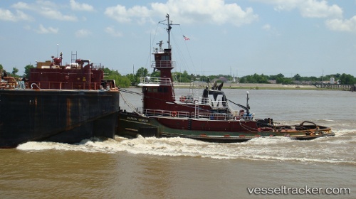
Vessel TOPAZ COAST IMO: 8121812, MMSI: 368149000 Tug
UTC, 36.84129, -76.26918, course: 147, speed: 0
UTC, 36.84124, -76.26926, course: 147, speed: 0
2026-01-31 11:35:45 UTC, 36.84134, -76.26926, course: 146, speed: 0
Live AIS position:
UTC. Near Norfolk),
updated 2026-01-31 11:35:45 UTC.
Find the position of the vessel TOPAZ COAST on the map. The latter are known coordinates and path.
marine traffic ship tracker show on live map
The current position of vessel TOPAZ COAST is 36.84134 lat / -76.26926 lng. Updated: 2026-01-31 11:35:45 UTCCurrently sailing under the flag of United States of America
TOPAZ COAST built in 1982 year
Deadweight:
10 tDetails:
Last coordinates of the vessel:
UTC, 36.84122, -76.26934, course: 147, speed: 0UTC, 36.84129, -76.26918, course: 147, speed: 0
UTC, 36.84124, -76.26926, course: 147, speed: 0
2026-01-31 11:35:45 UTC, 36.84134, -76.26926, course: 146, speed: 0